|
 |
|
Home Technical
|
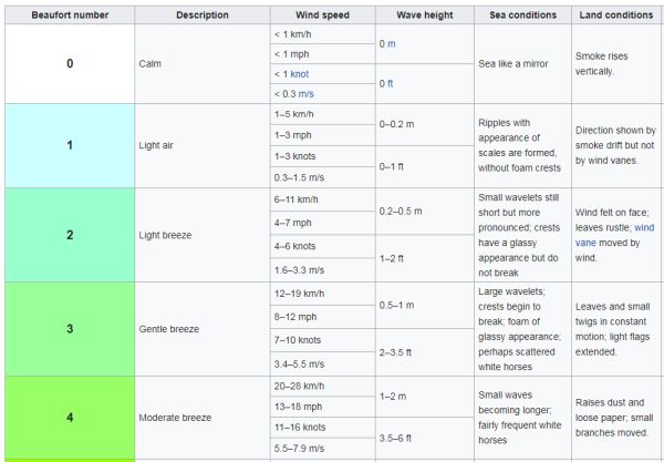
Weather Forecast Update As a result of a suggestion prior to Saltby was suggested as the location to use as it is a full size glider airfield not far from Buckminster. It turns out "YR" will find Buckiminster directly, listing it as an "Administrative division, England (United Kingdom)" as well as "Populated place, England (United Kingdom)". Metcheck.com couldn't find it at all. I am intrigued as to what "location" database is used, especially as "YR" comes from Norway, as when at home in Melton Mowbray I put YR on my tablet and let it "find" where it was; the location given was the "River Eye". I knew the River Eye runs through Melton but what I then discovered from Wikipedia is that it rises 6 miles NE of Melton, flows past Saltby, through the town where it changes to the Wreake and then flows into the Soar. Back in the 1990's I used to fly with the "Soar Valley Soarers". None of the above helps with actual forecasting but I have been very impressed with the amount of detail YR packs into its screens, all without any unnecessary extras. Good to see it using the
Beaufort Scale for its text description of wind
strength.
I have made changes to the Home Page "Weather" link as a result of being introduced to "YR" BMFA Buckminster have their own weather station attached to the
chimney of the office/house. Try here for a comprehensive report via the WeatherLink Network |